 |
||
|
|
||
|
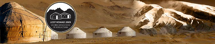
Facts The total area of Kyrgyzstan is 198,500 sq km (76,640 sq mi). The country is almost completely mountainous. More than half of Kyrgyzstan lies at an elevation higher than 2,500 m (8,200 ft), and only about one-eighth of the country lies lower than 1,500 m (about 4,900 ft). Glaciers and permanent snowfields cover more than 3 percent of Kyrgyzstan's total land area. Only 7 percent of the total land area is cultivated. Kyrgyzstan is located at the juncture of two great Central Asian mountain systems, the Tian-Shan and the Pamirs. The main ridge of the Tian-Shan extends along Kyrgyzstan's eastern border with China, on a north-eastern axis. Victory Peak (known as Pik Pobedy in Russian and Jenish Chokosu in Kyrgyz) is the highest peak in the Tian-Shan system at an elevation of 7,439 m (24,406 ft) and in the same time the highest peak of Kyrgyzstan and this area will be our playground for few weeks. If you like to read the diaries of our previous expeditions follow the links: Sacred Mountains 2007 Ski Cordillera 2006 Ski Cordillera 2004 |
|
||||||
|
Expedition | Diary | About us | Equipment | Partners | Facts | Guestbook | Media This website was made by EXPEDITION.SK - free websites of your expeditions.
Visits: 81934 |
|||||||